About
The Centre for Spatial Analysis and Policy (CSAP) - located in the School of Geography, University of Leeds - has a long tradition of providing cutting-edge data analysis and modelling using a range spatially referenced data applied to a number of policy related problems. CSAP is building on that tradition by making use of increasingly available 'big data' in many fields; and doing so by developing innovative ways of looking at the world to understand business, society and the environment at different spatial scales and by providing applied or policy-related analyses of geographical behaviour.
Our Main Research Areas
We have wide-ranging research interests in quantitative and computational geography. We develop advanced computational techniques and also apply other GIS and modelling methods to study areas of critical social importance such as changing populations, migration, geodemographics, retail science, education, crime and health.
CSAP strives to develop innovative ways of looking at the world to understand society, business, and the environment at different spatial and temporal scales. We use our strong commercial and public-sector links to provide applied analyses of geographical behaviour to answer key questions for future societies.
Our Blog
We will use this research blog to publicise the ongoing research in the Centre. If you would like any more information, see the main research group website, or our individual pages.
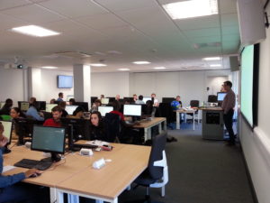
MSc students hard at work in our new lab.
Facilities
We have recently moved into newly refurbished offices in the Manton building. Our new space includes a bespoke 60+ computer laboratory with state-of-the-art facilities that we use for research, teaching, and running training courses. For more information about our new building, see here.